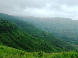
Panchagni is a beautiful hill station in Maharashtra located at an elevation of 1334m above sea level. It is on the river side of Shayadri ranges thus escaping the heavy rain and fog. Panchgani, literally stands for the place of five hills, is a famous hill station in Maharashtra. Panchgani is a vivacious scenic culture holidays destination and its beauty manifolds with the backdrop of craggy terrains at one side and coastal plains at the other side. This holiday destination had been utilized by the British officials as their summertime resort.
Among the many things that one enjoys about Panchgani hill station is the view that the region’s swoops with greenery: on one side lies the mighty Krishna river, whereas on the other, the coastal plains of Konkan. Once a popular British holiday resort, even today is rich in oxygen; it is also said that the water of the region contains traces of hemoglobin boosting iron. Panchgani is the quintessential hill station, with the British Raj stamped indelibly all over it. This place is conferred with constructions of British architecture, Parsi houses and the boarding schools. The destination, a natural relaxation spot, adds its conveniences with the comforting effect of cool breeze whispering through the thick woody regions. Panchgani summits many western plant form including poinsettia and silver oaks, which are in the beginning planted by British people.Tourist Attraction of Panchgani
Parsi Point: This point gives the most beautiful view around the Krishna Valley. The point is so named as it was a favourite spot for the Parsi community.
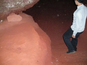
Rajpuri Caves:
Raapuri caves are situated about 10kms from Panchgani. It houses a temple of Lord Karthikeya. A temple of local goddess Ghatjal Devi is also found here. There are stone plates at the entrance of the caves. There are four main caves, three of them being joined by underground tunnels and one which is separate.The Lingmala Falls
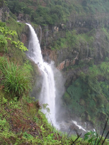
in Mahabaleshwar can be reached by road. It lies on the Mahabaleshwar-Poona road. The stream here precipitates over the face of steep cliff, unbroken when the torrent is swollen by rain but ordinarily divided by projecting rocks about one third of the way down into thin silver streaks and sprays often circled by rainbows. The forest bungalow of lingmala is also close by.Tableland: Tableland is the highest part of Panchgani at an elevation of 4550 feet above sea level. You can view some caves from here, one of them being Devil’s Kitchen. It is a place visited by many tourists as it provides many forms of entertainment like horse riding, mini trains and merry go rounds.
Sydney Point:
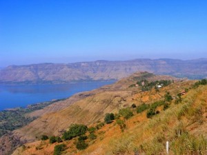
This point is on a small hillock and it is named after Sir Sidney Beckwarth, who was Commander in Chief and senior member of council, and temporarily succeeded Sir John Malcolm as the Governor of Bombay in 1830. From here, you can see the glittering waters of Dhom Dam.Devil’s Kitchen: Devil’s Kitchen is situated south of the tableland and is believed that the Pandavas stayed here for a while and used this place for cooking.
Dhoom Dham: Dhoom Dam is a major tourist attraction for tourists about 21kms away from Panchgani. It is a beautiful boating spot.
Adventure Activities
In Panchgani you can indulge in a number of activities including trekking and cycling. A number of trekking trails in the region allow you to explore this lovely hill station at your own pace and at the same time this is the best way to really appreciate the picturesque landscape surrounding you.
Panchgani accommodation
Hotels, inspection bungalows, private cottages, guest houses, etc. are available to suit all budgets. Panchgani abounds in family holiday resorts. One can get excellent discounts on accommodation via package tours.
Climate : 16 degrees in winter, 30 degrees in summer
Best Time to visit : September to May avoid monsoon session.
How to reach Panchgani hill station
By Air: Pune (98 kms) is the nearest airport; Mumbai-Pune connectivity is excellent.
By Rail: The nearest railhead is Wathar. However, Pune is a more preferable option as it boasts of better road transport connectivity to the Panchgani hill station.
By Road: Panchagani hill station is well connected to all the important cities in the region.
Panchgani map
Maharashtra, India


lyk it ………… visit jabalpur also