Kudremukh is a Kannada word which literally means “Horse face”. This hill town derived its name from a mountain range in the region that looks like the face of a horse. Kudremukh lies in the Chikmagalur district at an altitude of 1894 meters or 6214 feet above the sea level and overlooks the Arabian Sea coast. In 1916 the British Government had declared the Kudremukh region as a reserve forest.
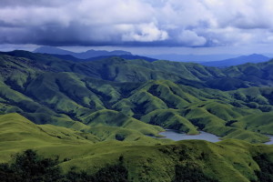
Kudremukh is believed to have the largest reserve of tropical wet evergreen forests in Karnataka. The dense forests covering the hills are linked to each other by valleys, grassy slopes, streams and rives, making it very rich in flora and fauna.
Natural grasslands and dense shallow forests make the verdure in the sequence of rolling hills in the northern, eastern and central areas of the town. Kudremukh, a part of the gallant Western Ghats, is famous for bio-diversity conservation and is discovered as one of the twenty-five hot spots in the world. A place acknowledged for mining ores, the ore company located in Kudremukh carries through mining operations, refinements and conveyance of the suspension to the Mangalore port through huge pipelines.Currently Kundremukh is flourishing as a modern township, thanks to the production oriented and profit making Ore Company. This has imparted fresh life to this part of Western Ghats and has altered this separated zone in the remote hill region into a humming location. Famous for its scenic beauty rich in wildlife beleaguered by natural thick forests, spotting wildlife is gainsaying. One has to go deep into the forest and only daring enthusiast is received. The drive through these dense forest ranges is highly pleasurable and enamoring. This is the origin of three very well known rivers – the Nethravathi, the Tunga and the Bhadra. An awesome Varaha statue of 6 feet inside an ancient cave and a temple of goddess Bhagavathi, are attracting many tourists here.
Kudremukh Prime Attractions
Kudremukh National Park :
Placed under the Global Tiger Conservation Priority-I, the Kudremukh National Park in the Western Ghats, area of about 600 square meter of a tropical evergreen wet forest, is the main attraction. It is declared as Wildlife Protected Area. Kudremukh National Park is placed under the format proposed jointly by World Wide Fund-USA and Wildlife Conservation Society (WCS).The national park is dwelling to many natural attractions, which can be visited with a special permission available at the National Park. Kudremukh National Park is developed based on the report of the noted environmentalist Dr Ullas Karanth. It was in 1987, this national park was formed in the Reserved Forests in Kudremukh. Endangered mammals and rare species are protected here in this park, includes the three large predator species – Wild dogs, Leopard and Tigers. This is the natural habitat of many other wild animals such as Common Languar, Wild Pig, sambar and Lion tailed Macaque.
Hanuman Gundi Waterfalls :
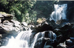
Situated close to Kudremukh is Hanuman Gundi waterfalls. The waterfalls come down onto natural rocks from a height of more than 100 feet. It is possible to trek to these falls and also go down to the base of the falls. There is a charge of Rs 30 for those who would like to go down the steps constructed by the forest department to get to the base of the waterfall.Gangamoola :
or Varaha Parvatha, a mount with a height of 1458 m above sea level within the border of National Park close to Kudremukh, is acclaimed as the source of three rivers Tunga, Bhadra and Netravathi originating from Western Ghats. It has the distinction of being a part of UNESCO designated World Heritage Site. This is the habitat of many rare species of birds. There are more than 107 species of birds in this range. There is a cave here which has a 6ft tall image of Varaha and a shrine of Goddess Bhagawati. The cave however is in accessible during the monsoons.Lakya Dam :
A check dam across the Lakya, the tributary of Bhadra river, built by Kudremukh Iron Ore Company is the so called Lakya Dam having a height of 100 m. The main utility of this dam is to collect the waste materials from the mining operations and since it is a dam of silt not water.The dam is at the backdrop of picturesque hilly terrains, shoal forests and calmly flowing rivers. It is argued that the Lakya dam has already made the submergence of 572 hectres of shola forests and raising the heights or constructing a new dam will submerge more areas. The dam and the surroundings are scenic and lots of tourists are attracted towards it.
Kalaseshwara Temple :
Kalasa meaning a water pot, is the abode of the Kalaseshwara Temple of Lord Shiva and is a holy temple-town and a tourist spot located near Kudremukh on the banks of river Bhadra. Local mythology points the origin of Kalasa connected to the wedding ceremony of Shiva and Parvathy. It is believed that visiting Kalasa bring punya, a greater religious merit. The Girija Kalyana, commemorating the marriage of Shiva and Parvathi, is an important festival here attracting many tourists.Jamalabad Fort :
Located in Kudremukh, the Jamalabad village is famous for its fort, Jamalabad fort, located 8 km north of Beltangadi town, is 1788 ft above sea level and used to be known as Narasimha Gudde, which refers to the granite hill on which the fort is built. It is also referred to locally as ‘Jamalagadda’.The fort, built by Tippu Sultan in 1794, was named after his mother, Jamalabee and is said to have been built over the ruins of an older structure. The fort is primarily inaccessible save a narrow path, with nearly 1876 steps to the fort that are cut out of this granite hill and lead all the way to the top through the fort to the summit. The timings to visit the fort are any time between 6.00 AM to 6.00 PM and an overnight stay at the Fort is strictly forbidden.
Kudremukh peak :
located as high as 1894 m above the sea level with forests covering the peak, is a perfect place for forest exploration. Kudremukh is trekker’s paradise with the luxury of its flora and fauna in the offing to be explored. This peak, a well-known spot for the navigators, overlooks the Arabian sea showing the distant zenith as a beautifully crafted spot.Sringeri : The pilgrimage town of Sringeri is about 5 kms from Kedramukh. The town is famous for its many temples here, the main one being the Annapurneshwari temple.
Horanadu :
is a holy city, laid in the middle of charming natural scenarios, for Hindus residing near Kudremukh. This place holds a beautiful temple Adi-Shaktyatmaka Shri Annapoorneshwari, a historical temple of Annapoorneshwari installed in 1973. The shrine renovated with a new idol of Adi Shakthi installed recently, is the main attraction in Horanadu. The place is attracted by plenty of pilgrims who are provided free boarding and lodging by the temple.Trekking in Kudremukh : Kudremukh an ideal place for trekking, with trails passes through lush green woods mixed with niceties of three interspersed rivers, charming cascades, grassy slopes and exceptional rarely seen orchids. For those who love natural beauty, visit to Kudremukh will be refreshing and breathtaking.
How to reach Kudremukh
Kudremukh is situated about 95 kms south-west of Chikmagalur, Karnataka. Mangalore is the closest airport to Kudremukh. The nearest railway station is also at Mangalore.
There are plenty of city bus and taxi service that can be hired from Chikmagalur. Tourist cabs are the best choice in case you want to tour the area all day or visit nearby places. Other nearby places are Sringeri and Kemmangundi.
Places To Stay – Kudremukh
Horticulture Department Guest Houses.
Forest Guest House.
PWD Guest Houses, Chikmagalur.
Naveen Lodge.
Indira Gandhi Road, Chikmagalur.
Planters Court, Moodigere Road.
Quality Inn, Indira Gandhi Road, Chikmagalur.
Woodlands, Indira Gandhi Road, Chikmagalur.
Kudremukh Map
Karnataka, India


